Vietnam: Day 16 – Day 18 – Mekong Delta Cycle

The Mekong Delta in southern Vietnam is a vast maze of rivers, swamps and islands, home to floating markets, Khmer pagodas and villages surrounded by rice paddies. Boats are the main means of transportation, and tours of the region often start in nearby Ho Chi Minh City (formerly known as Saigon) or Can Tho, a bustling town in the heart of the delta.

Continue ReadingVietnam: Day 16 – Day 18 – Mekong Delta Cycle

Vietnam: Day 2 & 3 & 4 – Bai Tu Long Bay

Bai Tu Long Bay is the name of an area located in the east of Halong Bay Vietnam. Although it shares many similar geological characters with Halong Bay, Bai Tu Long Bay is considered as off the beaten tourist track with many deserted and pristine beaches, no less impressive karst mountains. The Bay has a rich biodiversity with two ecosystems: a tropical, moist, evergreen rainforest ecosystem; and a marine and coastal ecosystem. The area has scarcely seen any tourist development. A large number of guests, through online research, wish to visit the Bai Tu Long Bay because it is much less crowded than Halong Bay. The only disadvantage is that it does not have many grottos. The nearest place for a visit (Vung Vieng Fishing village) is at around 20 km from tourist port.

Continue ReadingVietnam: Day 2 & 3 & 4 – Bai Tu Long Bay

Lesotho

Lesotho is called the “Kingdom of the Sky”. The Sani Pass is a gravel track connecting South Africa with the mountain kingdom of Lesotho. Rising 1332 metres to an altitude of 2876m in just 9 kilometres it has 1:3 gradients and numerous tight hairpins. It’s the most dramatic 4×4 drive in South Africa.

Continue ReadingLesotho

Peru: Rainbow Mountain

Vinicunca, also called Montaña de Siete Colores (Mountain of Seven Colors), is located in the Andes in the Cusco region of Peru. In order to get to the trailhead, it’s a three-hour drive from Cusco. To get to the lookout at 5,200m is about 10Km. The views are spectacular but do be cautious of altitude sickness.

Continue ReadingPeru: Rainbow Mountain

Peru: Lake Titicaca – Taquile

Taquile is an island on the Peruvian side of Lake Titicaca 45 km offshore from the city of Puno. About 2,200 people live on the island, which is 5.5 by 1.6 kilometres in size, with an area of 5.72 km². The highest point of the island is 4,050 metres above sea level and the main village is at 3,950 metres. The community of “Knitting Men”, people of Taquile Island are living the lifestyle they’ve preserved for centuries. When a man wants to marry a woman, he needs to prove his worth by drinking water out of his knitted hat. If the hat is knitted so tightly that the water doesn’t drip, he has successfully proved his abilities.

Continue ReadingPeru: Lake Titicaca – Taquile

Peru: Lake Titicaca – Uros & Amantani

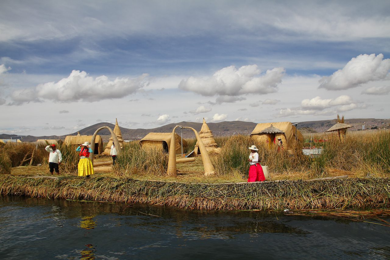
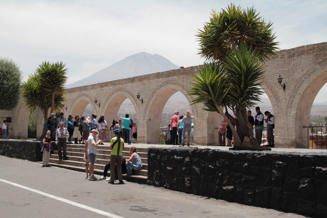
Lake Titicaca, straddling the border between Peru and Bolivia in the Andes Mountains, is one of South America's largest lakes and the world’s highest navigable body of water. Said to be the birthplace of the Incas, it’s home to numerous ruins. Its waters are famously still and brightly reflective. Around it is Titicaca National Reserve, sheltering rare aquatic wildlife such as giant frogs. The Uros islands are a group of 70 man-made totora reed islands floating on Peru's Lake Titicaca. Its inhabitants, the Uros tribe, pre-date Incan civilization and continue to hunt and fish the plentiful land and waters they occupy. Amantani is an island on the Peruvian side of Lake Titicaca and is the highest island in the world at 4,115m on Pachatata. According to a 1988 census, it had a population of 3,663 Quechua speakers divided among about 800 families. The island is circular and about 9.28 km² in size.

Continue ReadingPeru: Lake Titicaca – Uros & Amantani

Peru: Arequipa to Chivay

Arequipa is the colonial-era capital of Peru’s Arequipa Region. Framed by 3 volcanoes, it's filled with baroque buildings constructed from sillar, a white volcanic stone. Its historic center is anchored by the Plaza de Armas, a stately main square flanked on its north by the 17th-century neoclassical Basilica Cathedral, which houses a museum displaying religious objects and artwork.

Continue ReadingPeru: Arequipa to Chivay

Peru: Colca Canyon & Condors

Colca Canyon, a river canyon in southern Peru famed as one of the world's deepest, is a well-known trekking destination. It's a habitat for the giant Andean condor, on view from overlooks like Cruz del Condor. The canyon landscape comprises a green valley and remote traditional villages with terraced agriculture that predates the Incas.

Continue ReadingPeru: Colca Canyon & Condors

Peru: Nazca Lines

The Nazca Lines in southern Peru are a group of pre-Columbian geoglyphs etched into desert sands. Covering an area of nearly 1,000 sq. kilometers, there are about 300 different figures, including animals and plants. Composed of over 10,000 lines, some of which measure 30 meters wide and stretch more than 9 kilometers, the figures are most visible from the air.

Continue ReadingPeru: Nazca Lines

Peru: Ballestas Islands 

The Ballestas Islands are a group of small islands near the town of Paracas within the Paracas District of the Pisco Province in the Ica Region, on the south coast of Peru. The Ballestas Islands is an important wildlife reserve, with over 160 species of marine birds, including Humboldt penguins, cormorants, boobies and pelicans. There is also animal life, including vast numbers of sea lions. Condors can sometimes be seen flying overhead, especially in February and March, as they feed on the carcasses of dead sea lions. Dolphins and even whales can also be seen at times.

Continue ReadingPeru: Ballestas Islands